
Palmdale ZIP Code Coverage
The official Palmdale ZIP map shows why a ZIP code directory needs a geography check. The practical core set is 93550, 93551, and 93552. The map also shows 93591 and fringe polygons that touch or cross 93510, 93543, 91390, and Lancaster ZIP areas. It marks “LACO: Unincorporated LA County Pocket” in places where a postal-looking neighborhood can have a different public-record custodian.
| ZIP | Areas represented on the city map | Post or community label | Boundary note |
|---|---|---|---|
| 93550 | Central and south-central Palmdale, including the civic core | Principal Palmdale ZIP | Core city area; parcel edges still need checking |
| 93551 | West Palmdale, Rancho Vista, and west-side development | Palmdale | Postal reach is broader than a simple subdivision line |
| 93552 | East Palmdale residential area | Palmdale | Use the exact address for parcel and service jurisdiction |
| 93591 | Far east and northeast, near Lake Los Angeles | Palmdale postal name | Substantial city and county mismatch risk |
| 93510 | Southwest or Acton-side fringe | Acton | Touching the map does not make it a Palmdale resident area |
| 93543 | Southeast or Littlerock-side fringe | Littlerock | Postal place and municipal boundary diverge |
| 91390 | Southwest fringe | Santa Clarita or Agua Dulce area | Non-Palmdale postal label at the edge |
The official city ZIP map is the starting source for the Palmdale ZIP code directory. It is more useful than a generic list because it shows the city-limit relationship and county-pocket notation.
Palmdale's Core ZIP Code Set
93550, 93551, and 93552 are the ZIP codes most often treated as the core Palmdale postal areas. 93550 covers central and south-central sections. 93551 reaches west Palmdale and Rancho Vista. 93552 covers an east Palmdale residential area. These labels help sort a large search, but they do not replace the address, parcel, or city-limit check.
A person may use a Palmdale mailing city while living in a county pocket. A subdivision name may span a ZIP edge. A business record may use a mailing address that is not its operating site. For a residents-by-ZIP question, retain the full street address and inspect the parcel before assigning the result to the city.
The Census QuickFacts geography supplies city-level population and land context, not a person-level ZIP roll. Palmdale's 106.06 square miles make broad ZIP assumptions especially risky.
Why Palmdale ZIP 93591 Needs Care
93591 extends into far east and northeast geography near Lake Los Angeles. The postal name can say Palmdale even where the municipal boundary and county service line need a parcel check. This is the clearest Palmdale example of why a ZIP code directory cannot be used as a city roster.
Open the official map, locate the address in Mapping Palmdale, and compare the parcel with the city boundary. If the parcel sits in an unincorporated pocket, county Planning, Code, tax, or service records may apply even though the mailing city reads Palmdale. Keep the ZIP as a mail clue and the parcel as the jurisdiction clue.
Boundary check. A Palmdale postal label identifies a delivery route. It does not by itself establish city residence, city services, or Palmdale municipal jurisdiction.
Mapping Palmdale's GIS landing page provides the parcel and boundary tools used to test a 93591 address.
Palmdale Fringe ZIP Code Polygons
The city map shows 93510 on the Acton side, 93543 toward Littlerock, and 91390 on the southwest fringe. It also shows Lancaster ZIP areas north of the map extent. Those polygons matter when a family, deed, service record, or newspaper result crosses the Antelope Valley. They are regional clues, not proof of Palmdale city residence.
Use a fringe ZIP to widen a historical search, then return to an exact street, AIN, legal description, or census enumeration district. A result in Lancaster, Littlerock, Acton, Lake Los Angeles, Pearblossom, or Rosamond may fit a life history without fitting a Palmdale municipal record.
Geography also changes which office to contact. City records and county records can describe adjacent land differently. The official ZIP map's LACO pocket label is the strongest local clue when a visual neighborhood seems whole but the custodian changes.
ZIP Codes Are Mail Routes, Not Jurisdictions
A ZIP Code sorts mail. It does not define a city, county, school district, voting precinct, parcel, or service boundary. ZIP+4 adds delivery detail. A PO-box ZIP can describe a delivery facility rather than a residence. A carrier route is an operational delivery unit. None of those terms creates a Palmdale resident roll.
- ZIP Code
- A five-digit postal area used for delivery and address sorting.
- ZIP+4
- A nine-digit extension that narrows delivery within a ZIP. It is not a parcel identifier.
- PO-box ZIP
- A postal area associated with box delivery. It may not show a physical residence.
- AIN
- The county assessor's parcel identifier. It ties land and assessment history to a parcel, not a ZIP.
- Situs
- The physical property address. It is the address to compare with GIS and parcel records.
Use the postal address for delivery validation, then use the parcel and legal description for land and public-record jurisdiction. The difference is central to a Palmdale ZIP code directory.
Find Residents by Palmdale ZIP Code
A ZIP-keyed search should narrow the source before it tries to name a person. The assessor does not advertise a ZIP-only filter, so use a full address or AIN. The voter tool accepts ZIP only as one required self-verification field. CSLB accepts city or ZIP for a professional-license search, but its results are businesses or licensees, not residents.
- Write down the ZIP, postal city, full street address if known, and the reason for the search.
- Check the Palmdale ZIP map for core, fringe, and LACO pocket status.
- Use Mapping Palmdale to locate the parcel and compare city limits, zoning, and nearby services.
- For a property record, move from address to AIN and then to the assessor or recorder. For a public business, use the ZIP-capable CSLB tool.
- For one person, verify with a second record and keep ZIP evidence separate from residence proof.
Once a ZIP narrows the area, the Palmdale street directory by address takes over. Street-level work needs the full road name, direction, parcel, and legal description.
Official Palmdale ZIP Search Fields
The CSLB License Check is the clearest official ZIP-capable portal in the research. It accepts a city or ZIP plus one classification and can return a randomized list of eligible contractors whose license address falls in the selected area. This is a public professional directory, not a Palmdale residents directory. Its value here is showing the difference between a ZIP filter and a resident search.
| CSLB control | Type | Required | Format or note |
|---|---|---|---|
| City or ZIP Code | Location text | For location search | Use one city or five-digit ZIP |
| Classification | Selection | Yes for location search | Choose one license classification |
| License number | Numeric text | Alternative mode | Up to eight digits; no letters |
| Business name | Text | Alternative mode | Results can be capped at 50 |
| Personnel name | Last and first name | Alternative mode | Results can be capped at 100; partial 10-15 characters are suggested |
| Output | PDF or Excel choice | No | Selected results can be downloaded |
The database is unavailable Sunday at 8 p.m. through Monday at 6 a.m. The official CSLB ZIP search is the source for the portal fields and output limits.
The CSLB screen shows how a Palmdale ZIP search narrows a public license directory.
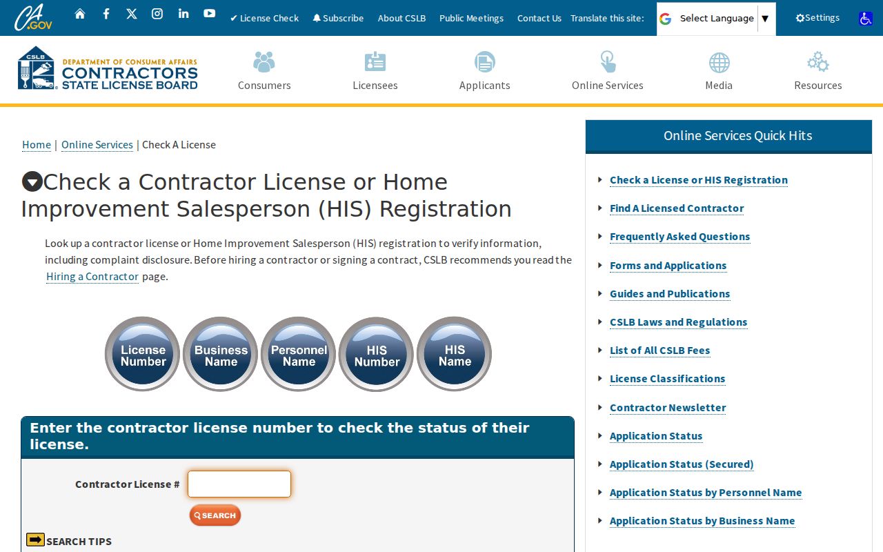
A ZIP filter is only as broad as the record set behind it. CSLB returns license records; it does not identify every person at a Palmdale address.
Palmdale ZIP, AIN, and Situs Lines
An AIN commonly appears as ten digits grouped like NNNN-NNN-NNN. It keys assessment and tax systems. A situs address keys mail, permits, GIS, and navigation. A legal description keys the land independently of both. A ZIP code keys delivery. When the four disagree, do not flatten them into one location.
Parcel splits and mergers can change an AIN. A modern ZIP map can cover land described under an older tract name. A street may use East and West forms, and Avenue P may also be called Rancho Vista Boulevard on portions. Save all variants with the date checked.
Palmdale GIS can help confirm local addressing. The research lists GIS at 661-267-5100, but a particular readdressing question should go to the city or county office responsible for that parcel. A ZIP code directory is a sorting layer, not the final proof.
Palmdale East-West Street Clues
Palmdale's grid uses numbered streets east and west around the Sierra Highway and Division Street corridor, plus lettered Avenues. Try both “10th Street East” and “10th Street West” when the record is incomplete. Avenue P, Avenue Q, Palmdale Boulevard, and Avenues R, S, and T can carry different local descriptions.
Old address research should include route aliases, historic place names, tract maps, and legal descriptions. The city grew from 2.1 square miles at incorporation in 1962 to roughly 106 square miles, so an address outside the old compact settlement may have always belonged to a county record system.
These details improve a ZIP code directory search because they keep a postal clue tied to the right road. They also make it easier to hand the narrowed address to an assessor or GIS workflow.
ZIP Code Boundaries vs Palmdale Limits
A Palmdale ZIP code can touch or cross the municipal boundary. The official map's unincorporated LACO pockets are not a minor footnote; they explain why adjacent homes can have different permit, code, tax, or service custodians. The same visual neighborhood can cross a city line.
Use the ZIP as a first filter, the GIS parcel as a second check, and the responsible agency as the final source. Do not use a ZIP to publish a person list. Protected voters, unlisted subscribers, renters, children, and private association members remain outside a responsible directory.
Keep the claim narrow. A ZIP can place an address in a postal area. It cannot, by itself, prove that a person resides in Palmdale or that the city holds the related record.
For a full road, move to the address workflow. For one person, use a name-and-record check. For an earlier household, follow the parcel backward through deeds, directories, census, and newspapers.